Hurricane Polo Swells Bring Dangerous Surf And Coastal Flooding To Southern California
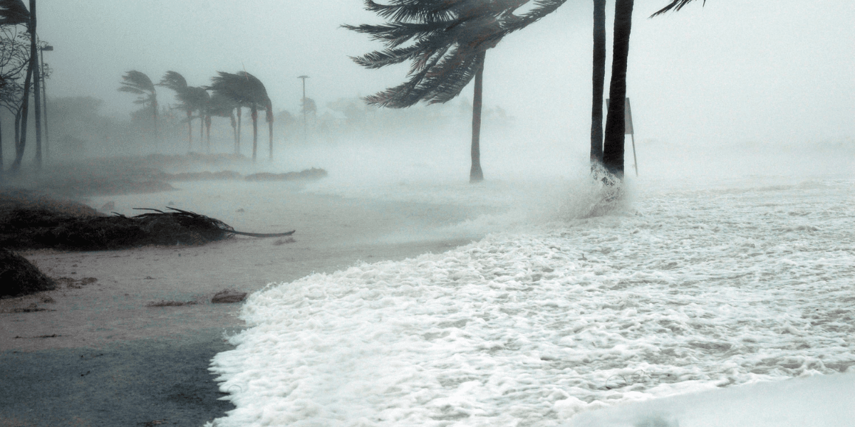
Powerful Pacific swells brought high surf, rip currents, erosion, and coastal flooding risks to Southern California beaches on September 28.
Southern California residents woke Monday, September 28, to a coastline under pressure. Powerful swells generated by distant tropical systems pushed toward beaches from Ventura County through San Diego County, combining with high tides to create dangerous surf, strong rip currents, erosion, and coastal flooding concerns. The National Weather Service issued coastal alerts across much of the region, turning an otherwise familiar day at the beach into one that required greater caution.
The source of the Southern California coastal hazards was hundreds of miles away. Hurricane Polo and post tropical cyclone Odalys were generating southerly swells across the eastern Pacific. Early Monday, the National Weather Service office in Los Angeles and Oxnard reported that Odalys was about 740 nautical miles southwest of Los Angeles, while Polo was roughly 820 nautical miles south southeast of the city. Forecasters expected swells from both systems to continue affecting Southern California waters through at least Tuesday.
By Monday afternoon, the National Weather Service had a high surf advisory and coastal flood advisory in effect for Catalina and Santa Barbara islands, Ventura County beaches, the Malibu coast, and Los Angeles County beaches through 5 p.m. Tuesday. Forecasters expected breaking waves of 4 to 7 feet, accompanied by dangerous rip currents. The agency warned that moderate seawater flooding was possible in vulnerable low lying coastal locations, particularly near high tide.
Conditions were also a concern farther south. In Orange and San Diego counties, the National Weather Service maintained a coastal flood advisory through Wednesday afternoon. Forecasts called for surf of 3 to 5 feet, with local sets reaching 7 feet on south facing beaches. Morning high tides were expected to reach approximately 6.8 to 7.1 feet through Wednesday, with the highest tide expected Tuesday morning.
Why The Southern California Coastal Hazards Matter
The numbers alone do not capture the full risk. Large waves can create powerful rip currents capable of pulling swimmers and surfers away from shore. Breaking surf can also wash people from beaches and rocks and create hazardous conditions for small vessels near the coast. The National Weather Service warned that seawater could reach some beach parking lots, bike paths, and harbor walkways. Moderate to locally significant beach erosion was also considered likely in vulnerable locations.
Some communities faced additional concerns because earlier wave activity had already weakened portions of the coastline. Federal forecasters specifically identified Avalon and areas of Long Beach, including the Peninsula and Belmont Shore, as locations of concern. Although the latest surf was expected to be smaller than the swell produced by Hurricane Marie earlier in September, lingering erosion increased the vulnerability of some coastal areas to additional flooding and damage.
The event illustrates how a tropical cyclone does not need to make landfall in Southern California to affect daily life along the coast. Swells can travel long distances across the Pacific and reach populated beaches even while the storm responsible for them remains far away. On September 28, the Los Angeles and Oxnard forecast office described high surf, beach erosion, and possible coastal flooding as the primary coastal effects from tropical cyclones well south of the region.
A surf zone forecast for Malibu and Los Angeles County beaches placed the rip current risk at high and forecast surf heights of 4 to 7 feet through Tuesday. That combination made conditions particularly important for swimmers, surfers, boaters, beach visitors, and residents in flood prone coastal areas to monitor.
What Southern California Residents Should Know
For coastal communities, the key takeaway is that wave height is only one part of the hazard. Tide levels, previous erosion, beach orientation, and local geography can determine whether a swell produces dramatic surf, flooding, or relatively limited effects. Conditions can therefore differ considerably between nearby beaches.
The National Weather Service advised people to remain out of dangerous surf or stay near occupied lifeguard towers, avoid rock jetties, and never drive around barricades or through water of unknown depth. Those recommendations are especially relevant around high tide, when coastal flooding can become more likely.
For Southern California residents and visitors, September 28 serves as a reminder that distant Pacific weather systems can have immediate effects at home. Monitoring official coastal forecasts, checking local beach conditions, and paying attention to lifeguard warnings can provide valuable information when surf and tides become hazardous.

Socal Journal Contributor
Covers regional events and community reporting across the Southern California counties.
This article features partner, contributor, or branded content from a third party. Members of the Socal Journal editorial staff were not involved in the creation of this content. All views and opinions are those of the contributor alone.
You May Also Like

Los Angeles Libros Festival Brings Bilingual Stories And Community Celebration To Central Library

The Other Art Fair Los Angeles Opens In Santa Monica With 160 Independent Artists
California Expands Climate Credits As Millions Receive September Electricity Bill Relief

Your Next Move Launches Founding University Partnership to Give Students Career Clarity Before the Job Search

Lucas Museum Of Narrative Art Takes Center Stage In Los Angeles Ahead Of Public Opening